Erwin to Damascus
This might be my favorite section so far
Day 36
Erwin had a surprisingly well stocked grocery store, though being a small town in the South almost everything was closed on a Sunday save for fast food. I ate a tub of hummus and pound of baby carrots as part of lunch - they had my favorite flavor of Cedar's balsamic caramelized onion hummus.
I was cruising along in the afternoon and came to the first shelter 4 miles out. Got sucked into a card game with a nice group I first met a while back, and end up camping together.
Day 37
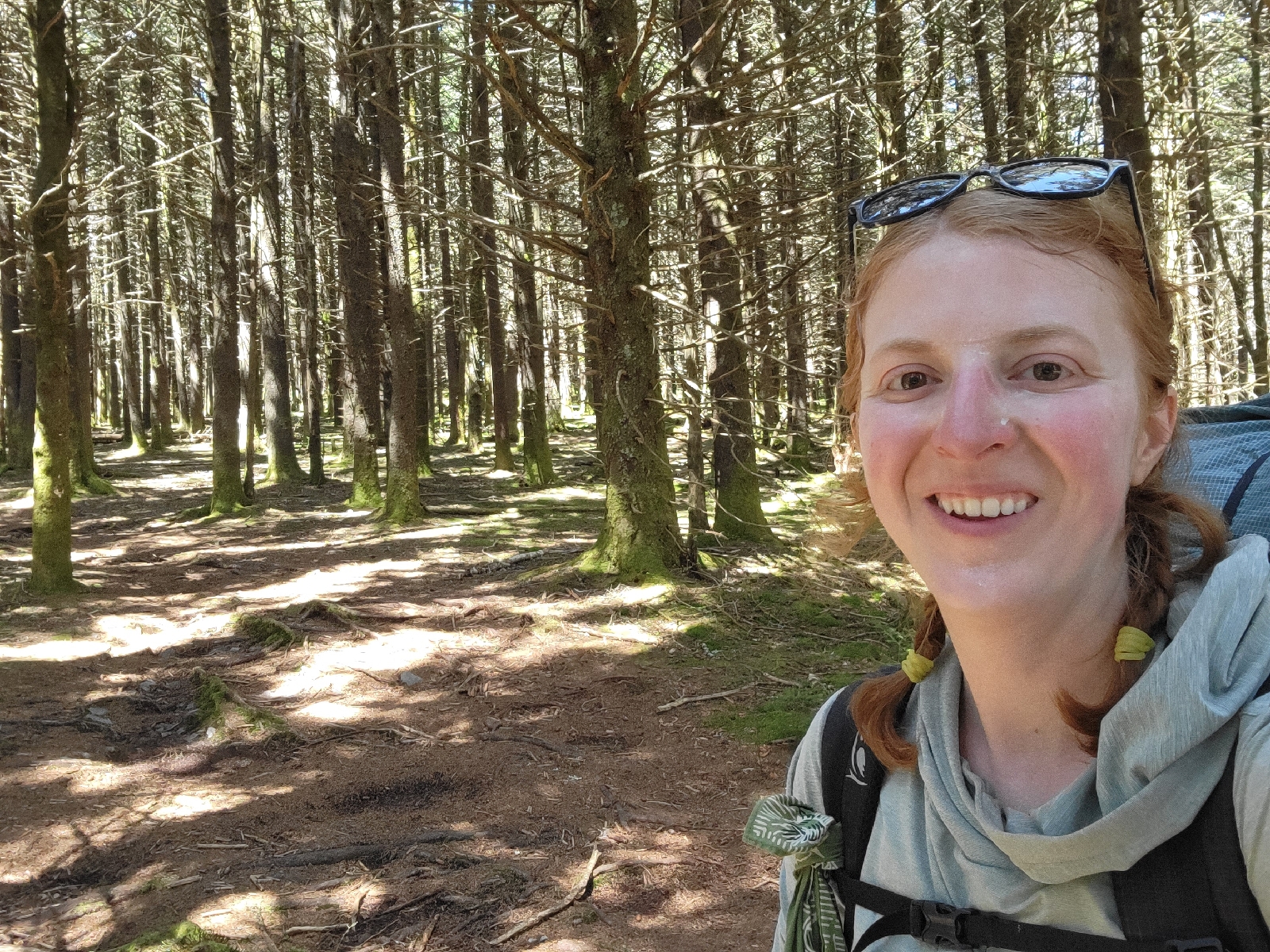
Hiked by a nice overlook called Beauty Spot, though I also enjoyed nearby Unaka Mountain. Towards the summit was a pine grove that gave off a distinct forest vibe. There was almost no understory growth, it was fairly dark in the middle of the day, and it was a very soft surface to walk. If you spend all day walking in the woods, yes the trees give off vibes.
I suppose I am now known for carrying bread strapped to the outside of my pack.
I had a normal loaf of sandwich bread after Hot Springs and a bag of everything bagels now after Erwin. It's a very satisfying lunch, but it's bulky. Not that the bread avoids getting squished, per se, but tying it outside the pack is a convenient location. I even packed out a tub of butter to pair with the bagels. Yes, it has gotten rather melted, but keeping it buried in the middle of the pack in a new/trusted/non-holey ziplock bag seems to work. Sadly I don't have photos of me and the bagels, sorry.
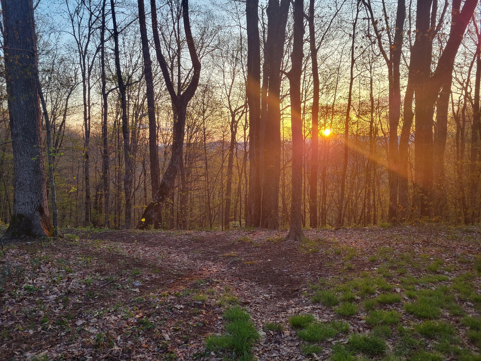
The group identified a nice open field area for camp. More importantly, it was shielded from the high winds. We even had a campfire, the first one I personally lit on trail.
As ane example of how I'm still learning, we talked about how everyone packs gear within their bags, and I'm planning to move mine from the top to more in the middle. It's a dense heavy item that should be more centered on your back, and I have had recent shoulder pain. This means you need to pre plan and set aside that day's midday snacks and lunch separately so you can access that without unpacking everything.
Day 38
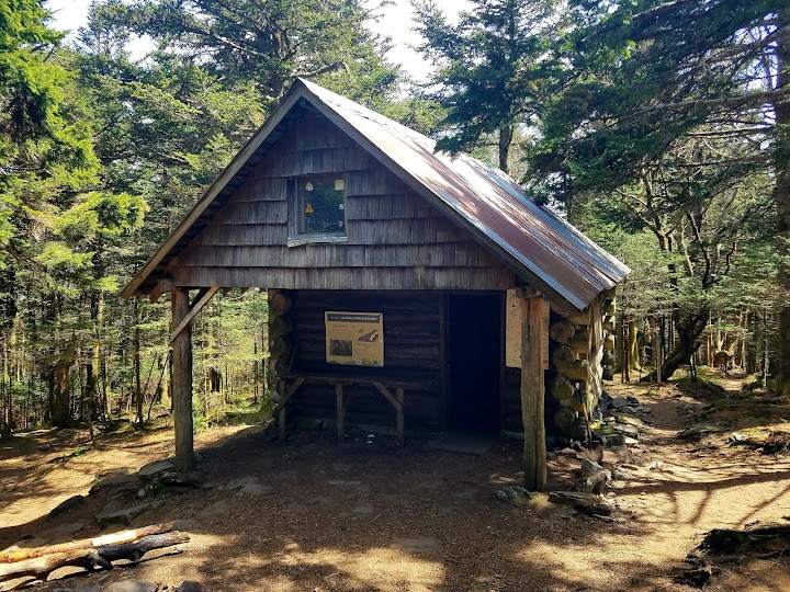
Today I hiked Roan Mountain, which contains the highest shelter on the AT at 6270 feet. Roan Mountain itself was a decent climb with many switchbacks (33 to be exact, though I counted 32 and a few maybes) to make the actual trail more gradual.
Why would I camp at 6000 feet on a cold and windy night? Well, given the choice with a fully enclosed (it had a door!) shelter including an upper loft, versus an unknown tent site without water, we stayed at the shelter. It was a shorter day at only 14 miles and change, so there was even time to watch a movie in the slumber party loft.
Mamy water sources have similar leaf spouts because it is much easier to fill a bottle than dunking it in a shallow stream. Rhododendron is a favorite because it is plentiful and sturdy - see the rocks holding it in place.
Day 39
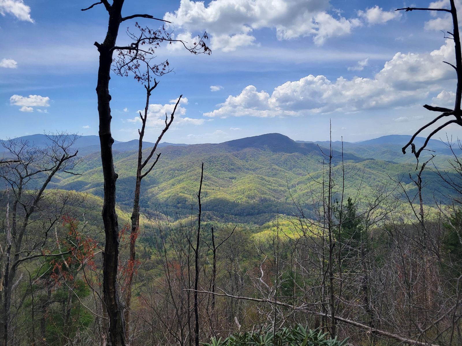
The Roan Highlands were so cool! It was a series of balds with rolling meadows and mountain views in the distance. The day was warm and sunny with clear skies, enough to make this redhead hike with long sleeves and the hood up, and there was almost no one on trail.
I gave up trying to capture this in a photo -landscapes at scale never look impressive through a camera lens.
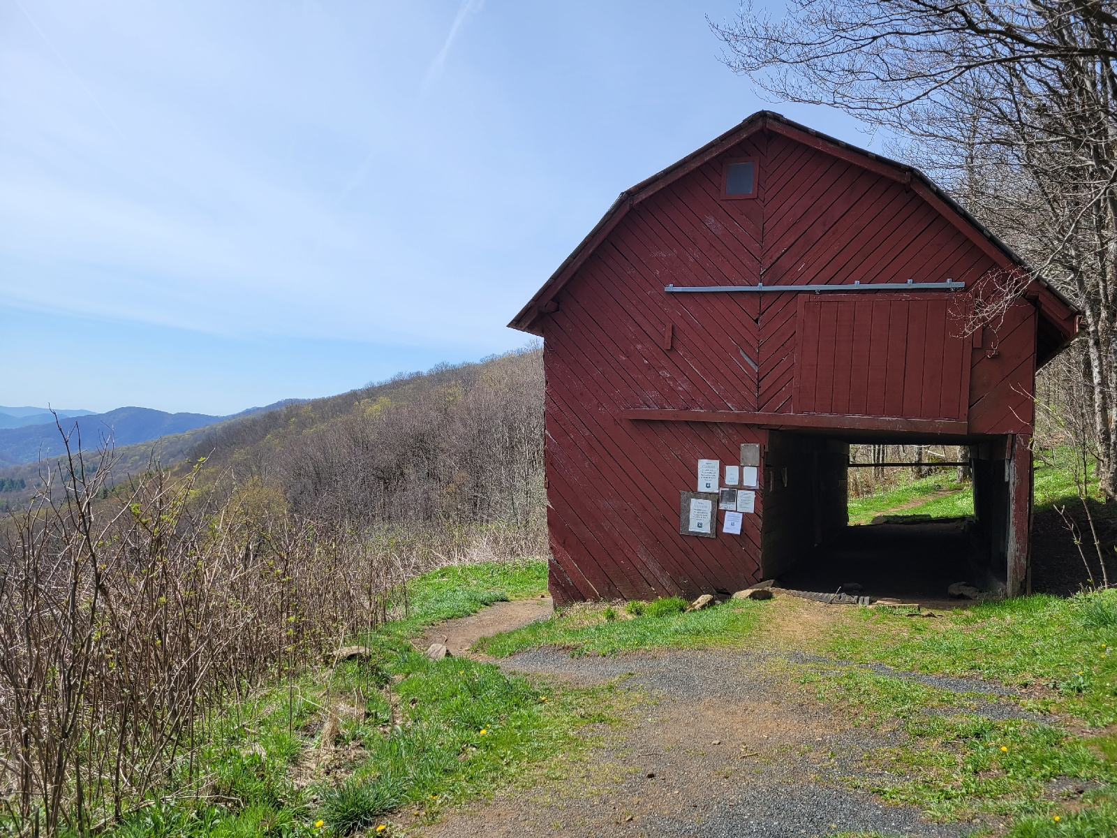
I stopped for my bagel lunch break at the historic Overmountain shelter, a converted barn that is famous along the AT but no longer in good repair enough to camp inside.
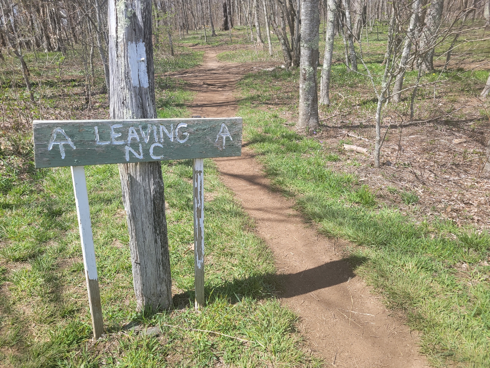
As mentioned before, the AT hugs the North Carolina Tennessee border for quite a while, but today marks the last time in North Carolina.
To round out quite the full day, we stayed at Mountain Harbour hostel in Roan Mountain, TN, and I met back up with my original hiking group! Actually, it was a packed house with about 20 people who I have shared camp with at some point over the last two weeks.
Day 40
Mile 400 on day 40! The first hundred meant the most, now they just keep on coming. I had to check my photos, it only took a week to get from 300 to here.
At the advice of the hostel owner, we all took the short detour to Jones Falls today. It was at least 80 degrees Fahrenheit, the first real hot day and almost no shade to speak of. If you climb up, you can dunk your head under the falls in the middle of the photo, behind the large boulder at right.
It wasn't really possible to photograph the sprawling camp we set up with 15 tents packed into any vaguely flat area. My definition of an acceptable campsite is definitely loosening, and the narrow footprint of my one-person setup worked in my favor tonight. Inflatable air pads do a pretty great job protecting from roots and rocks in the middle of your back, and you can stuff extra clothes under one side to help offset a little sloping.
Day 41
It was another hot day and several more waterfalls were visited. I did hike past mile 421 on 4/21, to continue the numbers trend.
Laurel Branch Falls is much bigger and farther than it looks. I didn't swim up to the falls but did wade in until the cold water numbed my feet
This section since Erwin has been one of my favorites with several days in a row of really cool views. I've also had good weather and good company. I would definitely recommend the Roan Highlands and this section along the Laurel Fork as excellent day hikes. Like most waterfalls, there's stair steps for days to get here, so be gentle to your knees as much as possible. The AT also hugs the river along a cliff right out of here, which was pretty fun, as I headed to the Laurel Fork shelter to wait out the predicted rain.
Day 42
Hung around camp for a bit to let the rain lighten up. I know I can't avoid rain forever, but I did avoid packing up a wet tent this morning. I crossed over Pond Mountain, where I again have to give credit to the trail builders and maintainers for the smooth trail with plenty of switchbacks. I stopped in for a quick pizza and resupply at a nearby hostel and only got sporadically rained on during the day. It wasn't enough to wear a jacket since I was damp from sweating anyway.
We lucked into some wonderful trail magic this afternoon. A church group had a tent set up with loads of fresh hot food, veggie burger for me, ears of corn, fruit, packaged snacks, home baked desserts, and ice cream sandwiches. They even sent us with PB&J sandwiches to go! Apparently, this group does trail magic for 10 Saturdays in the spring.
There was a good bit of rocky climbing, short yet tough, in the afternoon. Once you were on the ridgeline, it got slightly easier to hike.
In a series of unfortunate events, we managed to get my rope and another one stuck in trees within a half hour window. We were trying our best to follow bear protocol, but might have given up, if only temporarily.
Day 43
It was kind of funny - after passing the sign marking the edge of the Laurel Fork Wilderness, the rocks and roots practically disappeared, and the hills smoothed out noticeably. It made for an easy cruising day.
You might have to zoom, but at this junction there's a sign saying "not the AT", though I tore a tiny hole in my pack on a fence near here
Somewhat unplanned, today ended up being my first 20 mile day, with a total just under 23. The fast walking is only expected to increase as we get to gentler rolling hills in Virginia. I did have to stop before camp for a dinner break since my energy was crashing. While I don't think I have full hiker hunger yet, where you eat and eat and could keep eating, I definitely need more snacks than at the start of trail. Keeping daytime snacks handy is an ongoing balancing act.
I rolled into camp about 7 pm only to be told of a recent bear sighting. That bear came back less than an hour later! What a day to only have half a length of recovered rope to protect your food...
Day 44
No bears were known to have visited camp in the night and all food and gear was unscathed, but I did sleep poorly with paranoia.
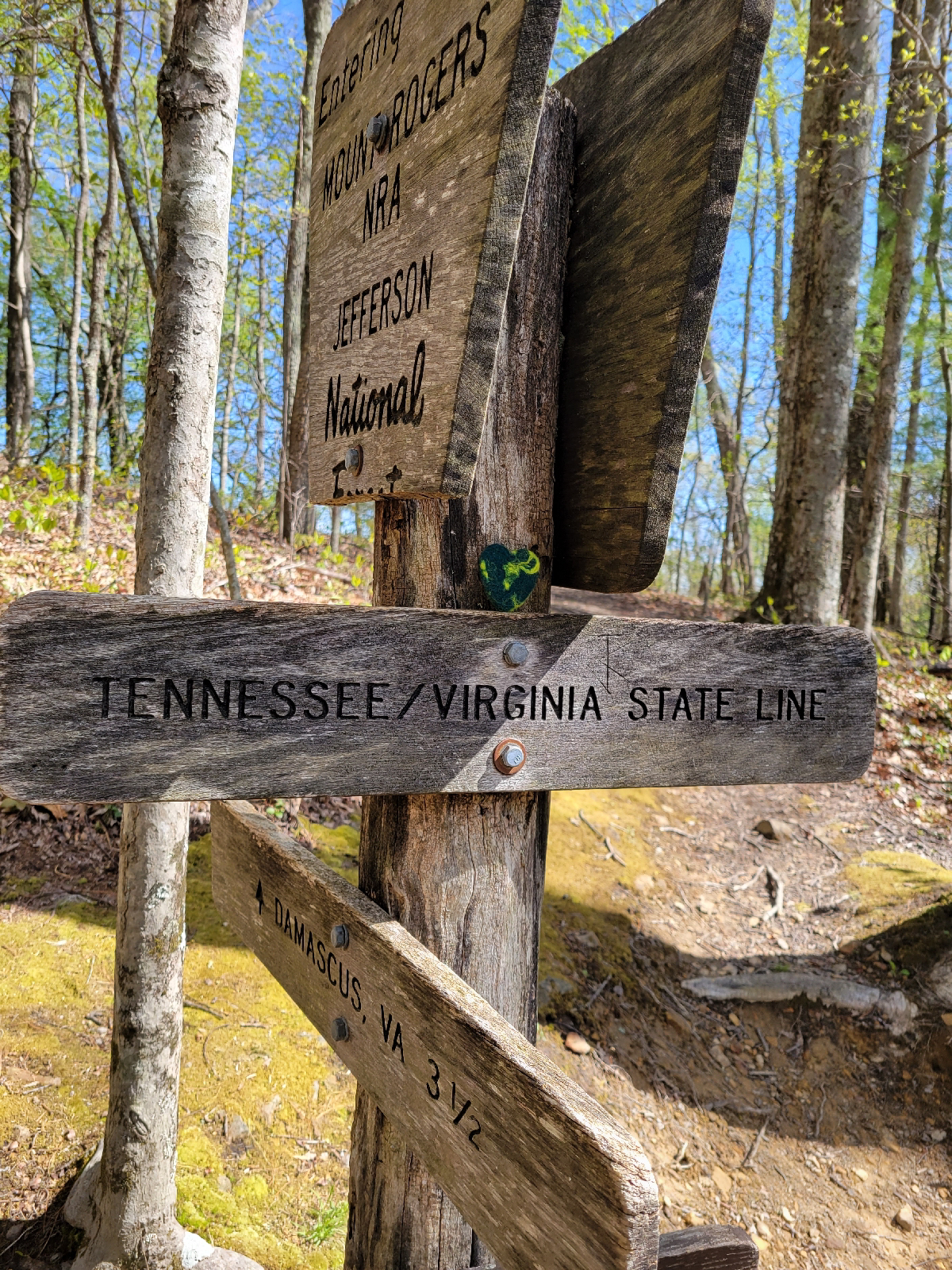
I picked up this little felted heart from the last trail magic. Expect to see it popping into more photos.
At least today was a nice mostly downhill 10 miles into Damascus. I felt good after my first 20, and given the choice it's more enjoyable to have time in town and push the day before.
Notable town food included a jumbo cinnamon roll with a solid inch of frosting on top. Don't worry, I also ate plenty of vegetables. I stayed at The Place, which is said to be the oldest hostel on the AT.
Happy hiking!













I think I missed that "Not AT" sign and had to backtrack a bit last year. You might want to shuttle back to Damascus for Trail Days. If you do, rent a bike for the Virginia Creeper Trail: 18 miles of Rails-to-Trails and its all downhill.
ReplyDeleteGreat photos! You are really cruising now. Thanks for sharing the scenic landmarks. Keep on hiking.
ReplyDelete