Daleville to Waynesboro
The post that was not destined to be
Sorry for the dramatic title, but I'm rather frustrated. My draft post has accidentally been deleted twice now, so I'm annoyed at the Blogger mobile app. Yes, after the first time I was saving regularly.
Day 62
The warm weather continues. If I feel noticeably tired when it's 80 degrees, how will July go?
Here in the East Coast, sometimes you can see the humidity. The trail today and in several sections follows the Blue Ridge Parkway, an official scenic byway with many overlooks that connects to Skyline Drive in Shenandoah National Park.
Day 63
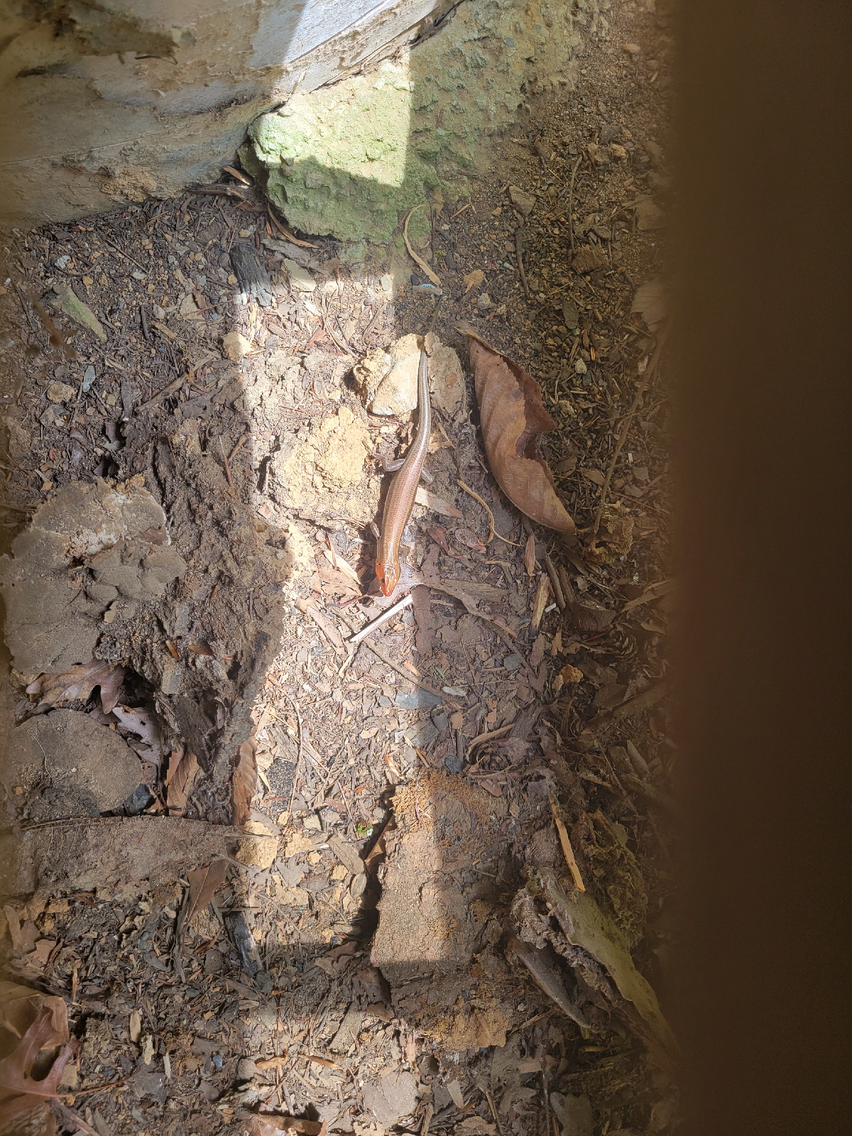
This part of Virginia seems to be full of lizards. Now, when I'm walking along and hear a sudden rustling in the leaf litter or understory plants, these little guys are the likely culprits.
No one ever accused squirrels of being calm, even-tempered critters. However, the lizard friends seem to move in short bursts and overall sound more frantic than the squirrels.
Another hiker told me that he keeps score of which creatures he startles. After hearing this, my tally for the next 5 miles to the shelter was: lizards 4, squirrels 6, and birds 1.
Day 64
Friendly reminder that the AT is not a wilderness expedition. Averaged across the entire length, it crosses a road every 4 miles, though some are more 4WD forest roads. Hikers resupply every 3 to 5 days, depending on pace and preference, and the towns are rarely more than a few miles away. Many days, even if the trail doesn't officially cross a road, with a side trail or a bit of bushwhacking, you could bail out of the woods to a nearby road. With few exceptions, I've been able to find cell service every day that I have checked in at least one likely location: ridges, hilltops, peaks and overlooks facing towns are good. Campsites in valleys much less likely. Note that geographic proximity doesn't mean the hiking is easy, just that most of the trail isn't crazy remote.
I wasn't sure if I was going to stay overnight in the tiny town of Glasgow where I had mailed my replacement poles. I'm glad I pushed through a 20 mile day because I soon learned that the local church provides a hiker dinner on Mondays. The people were lovely, and the dinner included brownies and ice cream. Today also was my greatest descent so far, breaking 6000 feet
From the hostel owners, I heard a harrowing bear story that happened less than 24 hours previously. The shelter closest to town was closed due to bear activity, so the couple in this story had camped a few miles before it. The couple was settled in, but during the night a bear enters their camp and will not leave. They get big (take up space and wave objects to appear larger than you are) and noisy, blow whistles, throw rocks, shine flashlights, but the bear is nonplussed and starts stomping its front feet. The couple is even on the phone with 911, but the operator is not a wilderness expert and asks questions like, "where is your car parked?" and "you walked here from Georgia?!"
The couple decides to abandon camp and take off on foot at night, with only cell phones and flashlights. They get picked up by forest rangers at the next road crossing and dropped off at the hostel around 1 am. Upon returning to camp the next day, 1 tent and 1 backpack are damaged, but I believe that the bear didn't get any food as it was stored properly.
Addendum: at the time of writing this, the camping ban was extended 10 miles. I never heard their names and don't know if they continued hiking or changed their plans.
Day 65
Facing a forecast of rain, I decided to do a short 10 mile day to the next shelter. Wet tents can be heavy if the fabric absorbs water, and airing out gear is another chore I prefer to avoid. A few others who had stayed at the hostel had the same idea, so we enjoyed hanging out at camp for a few hours.
Another food talk: dinner. I'd say people put the most effort into dinner compared to other meals. For those who eat only ready-made foods, tortillas with nut butter or meat and cheese are a favorite. Cold soaking opens up some dried options including instant potatoes, refried bean flakes, ramen, and couscous. Not all dried foods reconstitute well in cold water, even after several hours.
Using a stove gives you the most options. Freeze dried meals can provide unique flavors and ingredients, and these can range in quality alongside price. Freeze dried food is the most expensive option, though along a well travelled trail like the AT, they are fairly easy to find. Other staples include boxed macaroni and cheese and Knorr pre seasoned rice or noodles. Home dehydrated food is another option; dehydration is cheap and relatively easy but takes time and effort to prepare ahead of time and then mail.
Some people may be happy eating potatoes for dinner every day, but I am not one of them. I prefer a variety of textures and flavors. Sun dried tomatoes are a favorite of mine. Fried onion crisps (think toppings for green bean casserole at Thanksgiving) have a high calorie and flavor impact for little weight. Sauce packets and spices can have a big impact; dedicated fans carry entire bottles of hot sauce and Sriracha. Even the $2 ramen that comes with extra flavorings is way tastier than the cheapest stuff. Then, of course, there is the ramen bomb. This typically means a ramen and instant potato combo but can also mean everything-but-the-kitchen-sink mixed with ramen. It's the kind of food you only eat when you're really hungry.
Any food you are willing to carry that won't go bad before you eat it can be backpacking food. I've brought a bag of spinach for several days, and I witnessed a friend carry a glass jar of queso sauce. Creativity and access to a well stocked grocery store can get you pretty far.
Day 66
The trail had a nice flat section this morning along a reservoir, and due to the many streams and recent rain, the salamanders were out in droves.
This little salamander was exceptionally small. The heart in this photo is about 2 inches tall, for reference.
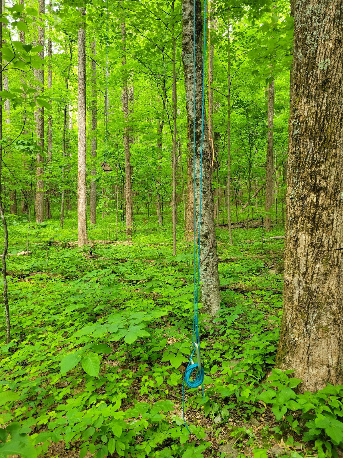
Through a comedy of errors, I lost another rope in a tree while hanging my food. With my poor aim, I got it tangled twice in smaller side branches, and the second time it became knotted beyond hope. I reached up on my toes and cut as much rope as I could recover. In the most literal example of "the trail provides", there was a piece of random Paracord lying at the base of the same tree. So, I find find another throwing rock, tie the two ropes together, and toss it again. My throw was good, but the knot immediately came undone. I tie the ropes again with a strange bulky join, having forgotten all proper bends, but this time it holds and my food survived the night unscathed.
I didn't like this rope anyway and had wanted to replace it. Be careful what you wish for.
Day 67
Today, I hiked one of the tougher sections in the northern half of Virginia. The Priest and its surrounding ridge were tough to climb and rather rocky.
The phrase "pointless up and down" or PUD is often used to describe the course of the Appalachian Trail. It may loyally follow the top of a ridge, climbing over every peak instead of skirting around some in the name of a smoother trail. Not all of this is complaining about hard terrain; steep trails are more vulnerable to erosion.
Technically, today's problem spot was not pointless as the two ridges were completely separated by a river valley. However, 3000 feet of descent immediately followed by the same climb again feels like a waste of effort. I was able to split it up so I camped after 1000 feet of climb (not ideal at the end of a hard day) and saved the rest for the morning.
This didn't quite photograph well, but I had to tie the end of my piecemeal rope to a long stick as a grab handle. The branch I picked was just a little too tall, but I made it work
Day 68
A quick guide to signs I see most every day on the Appalachian Trail, photo below. Top left: foot travel only. This one appears at trail junctions or road crossings. With a few tiny exceptions, bicycles, horses, and motorized travel are not allowed on the AT. Top right: wilderness area. In the southern half, the trail is located in national forest land a majority of the time. Designated wilderness areas are a classification of Forest Service land that have to be submitted and approved at the federal level as high value, for recreation and ecology. Wilderness areas are kept less developed, but the whole idea of "untouched wilderness" dismisses indigenous people and is a manufactured concept - a discussion for another time.
Bottom left: diamond shaped wood sign with the AT logo. I have only seen a few of these along the Blue Ridge Parkway and at large or popular trailheads. Bottom right: official AT triangle sign. Again, these are most common at significant road crossings and trailheads. The offset white blazes on the post indicate a left turn.
My loving father drove down to Virginia to pick me up for a wedding this weekend. This photo was taken at our meetup spot.
My dad was slightly aghast at my Sheetz order: bean burrito made out of a quesadilla with tater tots inside (God Bless American food). Plus a milkshake.
Day 69 and 70
Home for the wedding of a good friend from Girl Scouts and high school.
I wanted my zero days to be truly restful including some solid time sitting on the couch and doing nothing. I had plenty of to-dos, like laundry, repair, swapping out gear, grocery shopping, and a trip to REI. A sale at REI is a great way to lighten your wallet, but I was able to find things that met my specific criteria.
Day 71
Drove back down and had enough time to get some miles in. I felt like I tripped a lot more getting used to being on trail again, even after such a short break. On the other hand, tripping and stubbing toes is a daily occurrence. Sometimes, it indicates that you are particularly tired and need water, snack, or a break.
Even though I only hiked for a few hours, I lucked into some trail magic. The wife and son of a thru hiker were doing trail magic while the hiker slackpacked.
Day 72
A couple more miles before crossing into Shenandoah National Park. Luckily for me, the trail through the park tends to be well graded and have milder slopes than what I've hiked so far.
Speaking of signs, these concrete posts are iconic in the park. Mileage to nearby trails or features is stamped on the metal bands
I saw my first ever rattlesnake today! There was a large black snake stretched out fully across the trail. I didn't want to step over it, and going around wasn't really an option. I didn't initially realize that it rattled and was more distracted by the double wide section in the middle where the most recent meal had yet to digest. After about 10 rocks thrown at it, it started to make noise and sluggishly slither away. It took several more rocks before it had moved enough that I could sneak by.
I received more trail magic today. Some nice snacks and a cooler of sodas on ice were left along trail. Stroopwaffles were a fun find. Plus they had thoughtfully included two chairs so you could linger and relax.
Park adventures next. Happy hiking!


Seemed like a BIG snake- yikes! So glad you got to go to the wedding but it must have seemed surreal to be dressed up and in cute shoes! So many miles, and so grateful for the trail magic you’ve encountered. There really ARE Angels out there! Much love and virtual hugs till next time! ❤️
ReplyDeleteGreat photos- thanks for the trail sign info. Congratulations on your miles. Keep on hiking!
ReplyDelete